News
June 23, 2023
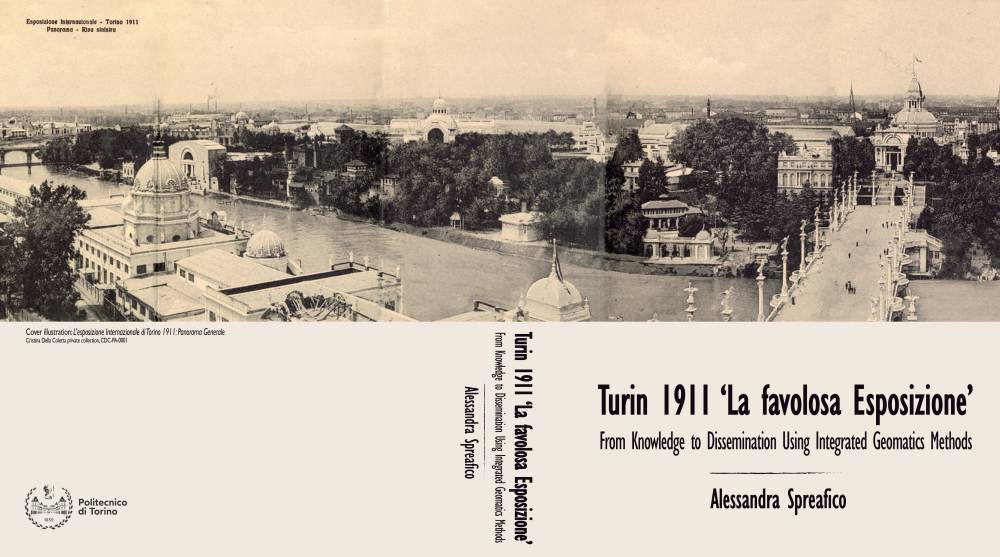
Ph.D Dissertation: Turin 1911 ‘La favolosa Esposizione’: From Knowledge to Dissemination Using Integrated Geomatics Methods
By Alessandra Spreafico
This research deals with the needs of documentation, virtual reconstruction, and visualization of dismantled Cultural Heritage (CH), particularly with the issues of data collecting, digitizing, cataloging, and disseminating source materials to document and study a World’s Fair through the application of Geomatics methods and techniques. In particular, the dissertation is focused on developing a 3D Web Geographical Information System (webGIS) dedicated to the 1911 World’s Fair of Industry and Labor in Turin (Italy) as the basis for the virtual 3D reconstruction and visualization of the no-longer-existing structures. Historical World’s Fairs aspired to be comprehensive expressions of a society in a specific time but were characterized by the concept of ephemera. Hundreds of people from around the World were involved in the conceptualization, creation, and documentation of this fictional world, a world meant to disappear at the end of the event. Considering the complexity of this phenomenon, a traditional study published in a book appears limited; a comprehensive study of a World’s Fair needs a multidisciplinary approach involving many experts working with a shared language and a common workspace where data can be stored and accessed remotely. This research is part of the Turin 1911 research project, which aims to digitally document, analyze and recreate the Turin World’s Fair with a multidisciplinary approach, thanks to the collaboration between scholars from the University of California San Diego and Politecnico di Torino. This dissertation faces the needs of the Turin 1911 project focusing on two sides: the setting up a 3D webGIS based on a tailored geo-database (DB) and integrated into a website and the online visualization of the reconstruction of the disappeared architectural structures as Building Information Modelling (BIM) models. The 3D webGIS represents the digital archive of the Turin 1911 World’s Fair where it is possible to collect, store, analyze, visualize, and navigate 3D contents and the data related to it in a user-friendly way. The 3D webGIS points at the geo-DB that is designed following cataloging principles – also using controlled vocabularies and linked open data - to make data understandable, consistent, linked, and able to withstand technological changes. The 3D webGIS provides the environment for the visualization and query of the content to the public. The system also allows the storage of digitized archival material, virtually collecting together all the fragile materials physically preserved in private and public archives worldwide. A simplified 3D model assists non-experts in generating the idea of what is physically lost today and relating it to the context. The development of a webGIS can deal with a single geo-DB and work in pairs with a traditional website designed as a ‘generous interface’ assisting the researchers in documenting and studying the World’s Fair. Finally, this dissertation proposes a first attempt to integrate the 2D and 3D online visualization of large data. The online platform aims to quickly navigate the virtual reconstruction of the disappeared architectural structures in the actual environment, combining different data types, such as raster and vector data, Triangular Irregular Network (TIN) surfaces, and BIM models. The approach developed in this dissertation provides a collaborative, interoperable, consistent, instantly up-to-date, and user-friendly environment. This system constitutes the unique space where the research itself takes place; here, scholars can easily cooperate to digitize, collect, catalog, analyze, and publish the material online. This way, all the data are easily accessible everywhere to the public with a smart device connected to the internet, without downloading software. The entire process involving the geo-DB and webGIS design and creation is tailored to the needs of the Turin 1911 World’s Fair. Still, the procedure can be replicated and, if properly adapted, it can be applied to other case studies.
See the Ph.D. dissertation on the Politecnico di Torino Research Institutional Repository.