News
July 20, 2020
M. Sc. Thesis: 3D Modelling and Virtual Reality using multi-sensor UAVs
By Davide Einaudi
Nowadays the research in photogrammetric field is dealing with the integration of information using multi-sensor solutions and the development of rapid mapping systems able to provide accurate information in a very short time. During the last decade, the market of low cost commercial camera has drastically increased, and in parallel, new sensors and camera typologies have been developed. In particular, the growth of multi-sensor solution allowed to produce spherical images commonly used for visualization, communication and documentation purpose (video and photo 360°, VR/AR applications). At the same time, the UAV (Unmanned Aerial Vehicles) civil market has exponentially increased allowing significant cost reduction and the sensor transport possibility has been enhanced. Drones photogrammetry application is a well established practice and have been successfully applied in a large number of operational scenarios.
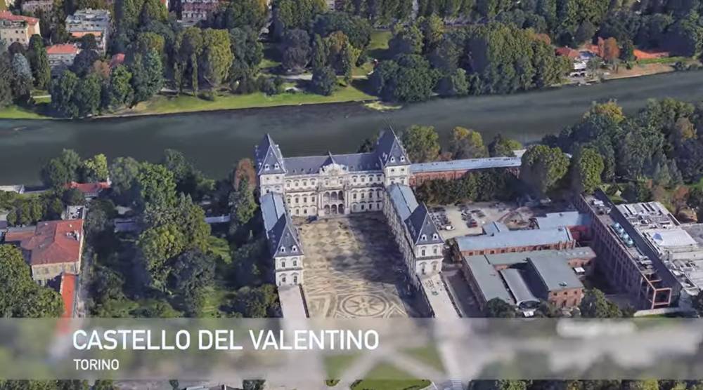
In the thesis some tests on the possibility of using spherical panorama in aerial acquisition with the aim to obtain valid architectural drawings, orthoimages, 3d models and digital elevation model (DSM) have been performed. The use of low-cost spherical camera solutions was followed in order to obtain accurate metric information according to the recent research trend in the geomatic field. The first application of this technology has been tested in terrestrial scenarios, while no significant works have been found in bibliography for aerial acquisition. In the present work a low cost commercial camera solution, composed of two fisheye sensors and a traditional camera (using a multi-image approach) has been used with the aim to test the 3d reconstruction capability. In the first part of the thesis the cameras have been calibrated using the photogrammetric approach in order to estimate the best mathematical model for every sensors. Furthermore specific tests have been performed in order to verify the accuracy of the final results. Another important aspect was related to the development of the 360° camera/UAV connection by testing different solution. Moreover, different tests were carried out taking into consideration two case studies (Castello del Valentino and the Borgo Medievale in Turin) in order to investigate the possibilities of using this technology on Cultural Heritage. In the work the pipeline for image orientation will be presented, combining images acquired from 360° and traditional cameras. Finally the use of spherical data for communication purpose through immersive navigation have been tested in Virtual Reality applications.
See the whole thesis on Politecnico di Torino Webthesis Library.